Seven thousand one hundred and seven islands at low tide. Most travellers see three.
The Philippines is an archipelago of 7,107 islands stretched across 1,800 kilometres of the western Pacific — three big island groups (Luzon, Visayas, Mindanao), about 2,000 inhabited islands, 110 million people, and roughly 80 living languages. The world's largest English-speaking population per capita outside the US, UK, and Australia. The only Catholic-majority country in Asia, except for Mindanao's south, which flips Muslim. A country that doesn't quite fit any regional box.
Most international travellers see Boracay, El Nido, maybe Cebu, and conclude they have seen the country. Three islands out of seven thousand. What lies past those is where the Philippines actually lives. Batanes, the northernmost province, is closer to Taiwan than to Manila and has stone houses built to withstand typhoons that flatten ordinary architecture. Siargao, off the eastern coast of Mindanao, is the country's surf capital and feels nothing like Cebu. Siquijor has no airport and a generations-old folk-magic tradition that Filipinos themselves take seriously.
The connecting thread is logistics. Boats, small-island flights, language nuance (Tagalog up north, Cebuano in the centre, Hiligaynon in Iloilo, Ilocano in the north-west, plus dozens more), and a regional politics that shifts the moment you cross between island groups. Operator-led travel is the difference between a Philippines trip that adds up and one that doesn't. Independent travel here is possible and rewarded, but the planning load is real.
The country is also still in motion — the long economic shadow of the pandemic on a tourism-dependent economy, a new administration's quietly different posture on China, the slow rebuilding of provincial airports. The version of this country in 2026 is not the version your friends saw in 2017. Whatever rule you read recently is probably already partly out of date.

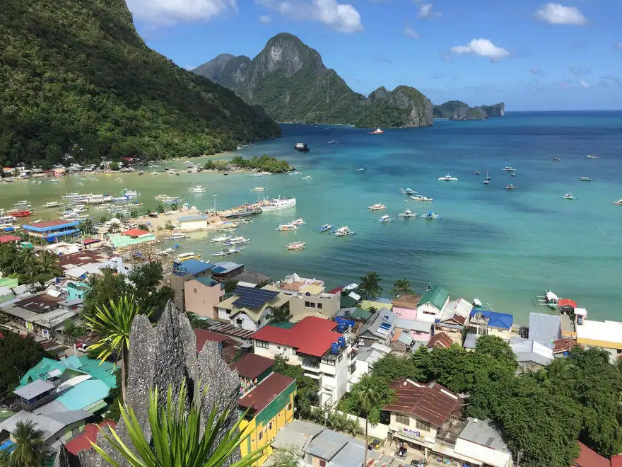
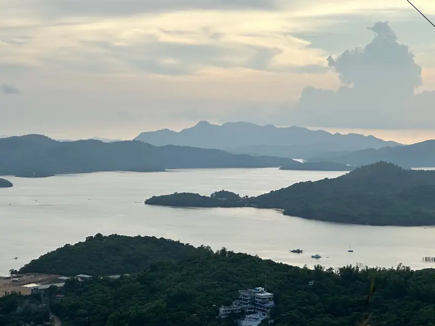
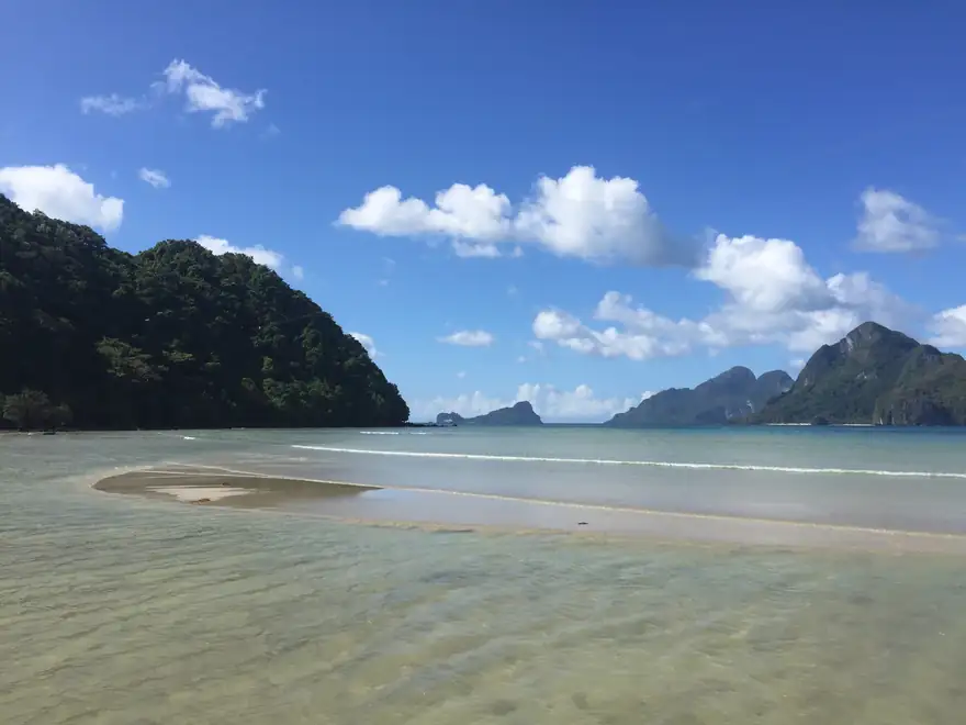
Palawan · El Nido and the limestone karsts
Philippines · Palawan
The Limestone Karst Islands
Palawan is a long, thin island stretched along the Philippines' western edge, separating the South China Sea from the Sulu Sea. El Nido, in the north, is the postcard — limestone karsts rising vertically from turquoise water, hidden lagoons reachable only by kayak, cathedral caves you swim into. The crowds are real, but the geography is bigger than the crowds. A good boat day in the Bacuit archipelago still feels approximately like nobody else has been there.
Coron, on Busuanga island to the north of El Nido proper, is where divers go. World War II Japanese shipwrecks rest in 30-metre water, accessible to recreational divers, with whole engine rooms intact. The lakes — Kayangan, Barracuda — have a freshwater layer over saltwater that produces visibility you don't get anywhere else.
The deeper south of Palawan — Port Barton, San Vicente, the Underground River near Sabang — is where you go to escape the El Nido crowd. Operators who actually know Palawan move you between these. The country's longest beach, at Long Beach in San Vicente, is 14 kilometres of empty sand. Most travellers never make it down there.

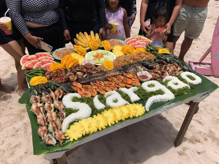
Siargao · the country's surf coast
Philippines · Siargao
Surf, Mangroves, and the Slow Town
Siargao is a teardrop-shaped island off the eastern coast of Mindanao — surf country, mangrove country, and the kind of slow tropical island that disappears most of the year and gets discovered every five years. Cloud 9, the right-handed reef break at the island's south end, is where the country's surf reputation comes from. The wave is heavier than it looks; the reef is shallow.
The town of General Luna, near Cloud 9, has expanded fast in the last decade. Yoga retreats, surf schools, restaurants run by chefs who used to cook in Manila or Madrid. It is, increasingly, an internationalised place. The northern half of the island remains its own slower world — mangrove tunnels you paddle through at high tide, rock pools, the Sugba Lagoon a thirty-minute boat ride away.
Typhoon Odette, in 2021, levelled most of Siargao. The recovery has been impressive but uneven. Some of what you'd read about a 2020-era guide is gone; new things have replaced them. Operators who have been on the island long enough to remember the rebuild are the ones to ask.
Philippines · Batanes
The Northernmost Islands
Batanes is the smallest, northernmost province of the Philippines — ten islands closer to Taiwan than to Manila, lying directly in the path of every typhoon that crosses the western Pacific. The Ivatan people, who have lived here for centuries, build their houses out of limestone and coral, walls a metre thick, roofs of cogon thatch lashed against the wind. They call the architectural style “maytuab.” It works.
The landscape is unlike anywhere else in the country. Rolling green hills above sheer cliffs, a treeless feel that belongs more to the Faroe Islands or Iceland. There are no McDonald's. The roads are narrow and well-paved. You rent a scooter and circle Batan Island in a day. Sabtang, the smaller island reached by a short and frequently rough boat ride, holds the most preserved Ivatan villages.
Tourism is small. Flights from Manila are limited and weather-dependent — Batanes is not somewhere you arrive on a tight schedule. Operators who specialise here build in buffer days. The Ivatan honesty store — a roadside hut where you take what you want and leave the money — is famously real. It is also a useful indicator of how the rest of the place feels.

Bohol · Chocolate Hills, tarsiers, Loboc
Philippines · Bohol
Chocolate Hills and the World's Smallest Primate
Bohol's Chocolate Hills are 1,200-odd cone-shaped limestone mounds rising out of the centre of the island, all roughly the same height, all turning brown in dry season — hence the name. They are an actual geological mystery, the result of marine limestone uplift and weathering, but the visual effect is uncanny: a planted-looking landscape that seems too uniform to be natural.
The Philippine tarsier — one of the world's smallest primates, a nocturnal creature with eyes the size of its skull — lives in the Loboc-area sanctuary. They are stress-prone, so visits are quiet, brief, no-flash photography only. Outside the sanctuary, the Loboc River runs through bamboo forests and ends at a coastal mangrove. A river cruise here has become a tourist staple, but the side roads above the river are mostly empty.
Panglao, off Bohol's southern coast, is the diving and beach end of the island. Alona Beach is the main strip. The reefs at Balicasag Island, twenty minutes by banca, are some of the best in the central Visayas. Bohol pairs naturally with Cebu — ferries between them run hourly — and most travellers do both in a week.

Cebu · Kawasan, Malapascua, Moalboal
Philippines · Cebu
Thresher Sharks and the Sardine Run
Cebu is the second-most populous city in the Philippines and the country's oldest — the place where Magellan landed in 1521 and the place where Lapu-Lapu killed him a few weeks later. The historic centre, around Fort San Pedro and Magellan's Cross, is a quick afternoon. Most travellers use Cebu City as a base and head out to the rest of the island and the surrounding ones.
Malapascua, off the northern tip, has a near-daily diving event — thresher sharks coming up from deep water at dawn to clean at Monad Shoal. The dives leave at 4 a.m. and most divers are back at the resort by 8. Moalboal, on Cebu's south-western coast, has a permanent ball of millions of sardines you swim through, plus a turtle population that doesn't move when you approach.
Inland Cebu has Kawasan Falls — turquoise tiered waterfalls reached by a short hike — and the Osmeña Peak ridge. The Argao region, two hours south of the city, is older and quieter and has the country's best ube cooking. The pace shifts the moment you leave the city.
Philippines · Banaue & Cordilleras
The Rice Terraces of Two Thousand Years
The Banaue rice terraces are roughly 2,000 years old, hand-built into the Cordillera mountains in northern Luzon by the Ifugao people, and still farmed by the same families. The terraces in Banaue town itself are well-known. The terraces in Batad, a nearby village reached by a one-hour hike, are spectacular and harder. The amphitheatre formation at Batad is what gets photographed; the terraces still in cultivation are what the trip is actually about.
Sagada, three hours west, is a different world — an upland village famous for its hanging coffins (a centuries-old burial practice in which coffins are nailed or wedged to limestone cliffs) and its pine forests, which look more like Wyoming than what you expect from the Philippines. The cool altitude makes it the country's coffee region. The Sumaguing Cave network is one of the better caving experiences in Southeast Asia.
The Cordilleras are slow to reach. Manila to Banaue is 9 hours overland, often longer if the buses are full. Most operators run multi-day Luzon-north circuits combining Banaue, Sagada, Batad, and the rice-fields above them. The drive itself is half the experience — up through Baguio, into the spine of Luzon, then down into terrace country.

Siquijor · the island the Filipinos consult
Philippines · Siquijor
The Island the Filipinos Consult
Siquijor has no airport. There's no McDonald's. The island is 78 kilometres around — you can drive it in a day, but most people take three. Filipinos themselves come here to consult the healers. The folk-magic tradition — herbal medicine, ritual healing, what the rest of the country half-jokingly half-seriously calls “black magic” — is not a tourist performance. It is something the locals take entirely seriously and which the rest of the Philippines has never quite stopped consulting.
The Cambugahay Falls system — three turquoise pools tiered through forest — is the swimming spot. The Salagdoong Beach has cliff jumps off limestone outcrops. The 400-year-old balete tree at Lazi has roots that fan out across an entire spring-fed pool, and locals leave offerings under it.
Siquijor's reputation as “the mystical island” means most international travellers either build it up wildly or skip it. The reality is quieter and more interesting than either. It's small, it's slow, the food is local-Filipino without much restaurant infrastructure, and the people you meet are mostly farmers or fishermen or healers. A few days here changes the rhythm of any Visayas trip.
Philippines · Camiguin
The Island Born of Fire
Camiguin sits a short ferry ride north of Mindanao — a small volcanic island with seven volcanoes, three of them still active, a sunken cemetery (a graveyard submerged when one of the volcanoes erupted in the 1870s; you snorkel over it), hot springs, cold springs, and the country's best lanzones (a sweet citrus fruit). The island has a circumference of about 64 kilometres.
Mount Hibok-Hibok, the most active volcano, last erupted in 1951. The hike up takes about 8 hours round-trip, with a guide, and ends with a view that takes in most of the island and the Mindanao coast across the strait. Mantigue Island, just offshore, is a small marine sanctuary with healthy reef and clear water.
Camiguin sees a fraction of the international tourist traffic of the bigger islands. Most visitors are Filipino, mostly from Mindanao. A long weekend here, before or after a Mindanao trip, fits naturally. The October Lanzones Festival is the country's most local-feeling fruit harvest celebration.
Philippines · Davao
Mount Apo and the Heart of Mindanao
Davao City is the largest city in Mindanao and the gateway to the country's southern third. Mount Apo, the Philippines' highest peak at 2,954 metres, is a 3-day climb from one of the trailheads outside the city. The summit ridge passes through cloud forest, sulphur springs, and a barren upper slope that doesn't look quite like the rest of the country.
Davao itself is the Philippine capital of fruit, particularly durian — consumed at street stalls, debated like wine, and the subject of an entire local economy. The city has a famously low crime rate and a different administrative culture from Manila. It is also the gateway to the Philippine Eagle Centre, where the country's national bird (a critically endangered raptor) is bred and rehabilitated.
Beyond Davao, southern Mindanao opens up into surf coast (Dahican near Mati), the Lake Sebu T'boli weaving region, the Samal Island beaches, and the long road south to General Santos. Some sub-regions of southern Mindanao have travel advisories — the Sulu Archipelago in particular — and operator-led travel here is the right move for navigating which areas are open and which aren't.