In Bhutan, the mountains are gods and the forests are protected by constitution. Landscape and faith are the same thing.
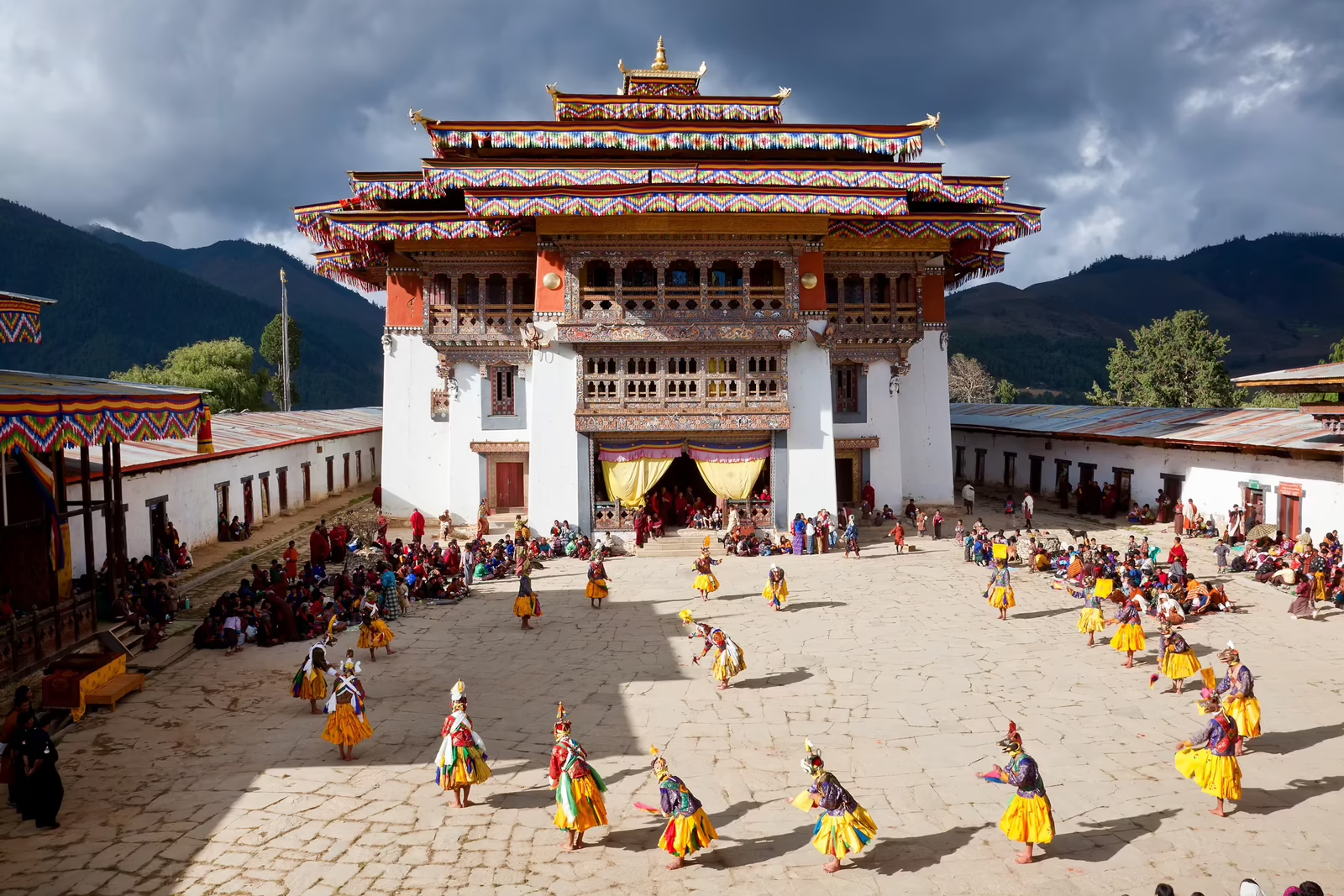
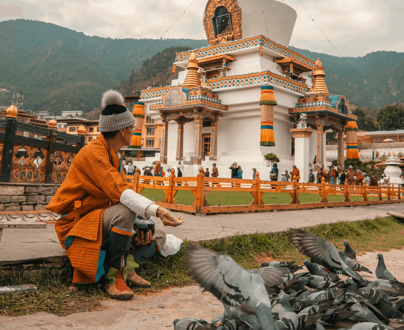
Mahayana Buddhism doesn’t sit on top of Bhutanese life — it runs through it. Monks in red robes cross the road in cities and villages. Prayer wheels turn at every dzong entrance. Karma is treated less as a metaphor than as a practical accounting system, like double-entry bookkeeping for the soul. The result is a culture that pauses, repeatedly and unselfconsciously, to acknowledge the unseen.
Bhutan has 71% forest cover — the constitution requires a minimum of 60% — and those forests absorb roughly three times the carbon the entire country produces. A daily Sustainable Development Fee of $100 per visitor funds free healthcare and education for citizens and maintains the dzongs and temples. None of this is felt as policy. It is felt as continuity with what was already true.
What this produces is a country that does not feel managed. The prayer flags are here because they have always been here. The monks are not posing. The farmers in the Paro Valley work the same rice terraces their families have worked for centuries. Places on earth that are still largely intact are rare. Bhutan is one of them. From here, a different kind of travel begins.
Jigme
Bhutan local
“Bhutan is changing slowly, on its own terms, and I’m lucky to live in the version that’s still here. Most visitors arrive thinking they’re coming for the dzongs and the mountains, then leave changed by something else — usually a conversation with a stranger over butter tea. Ask me anything. There’s no rushing this place; I love walking the valleys with people who want to slow down with us.”
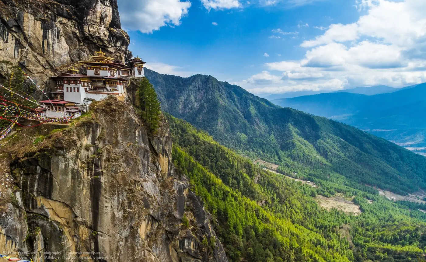
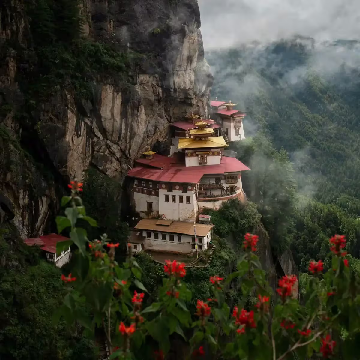
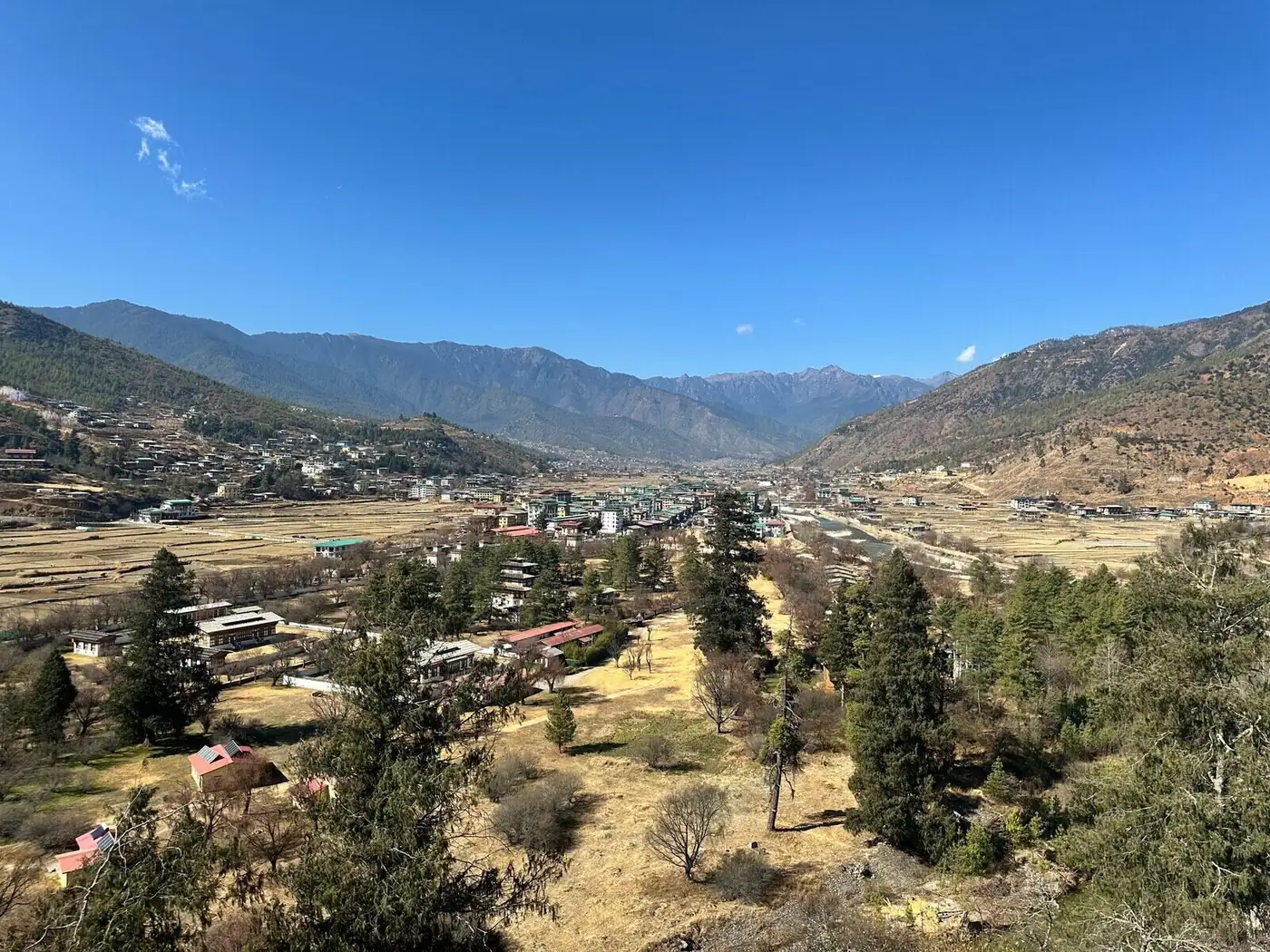
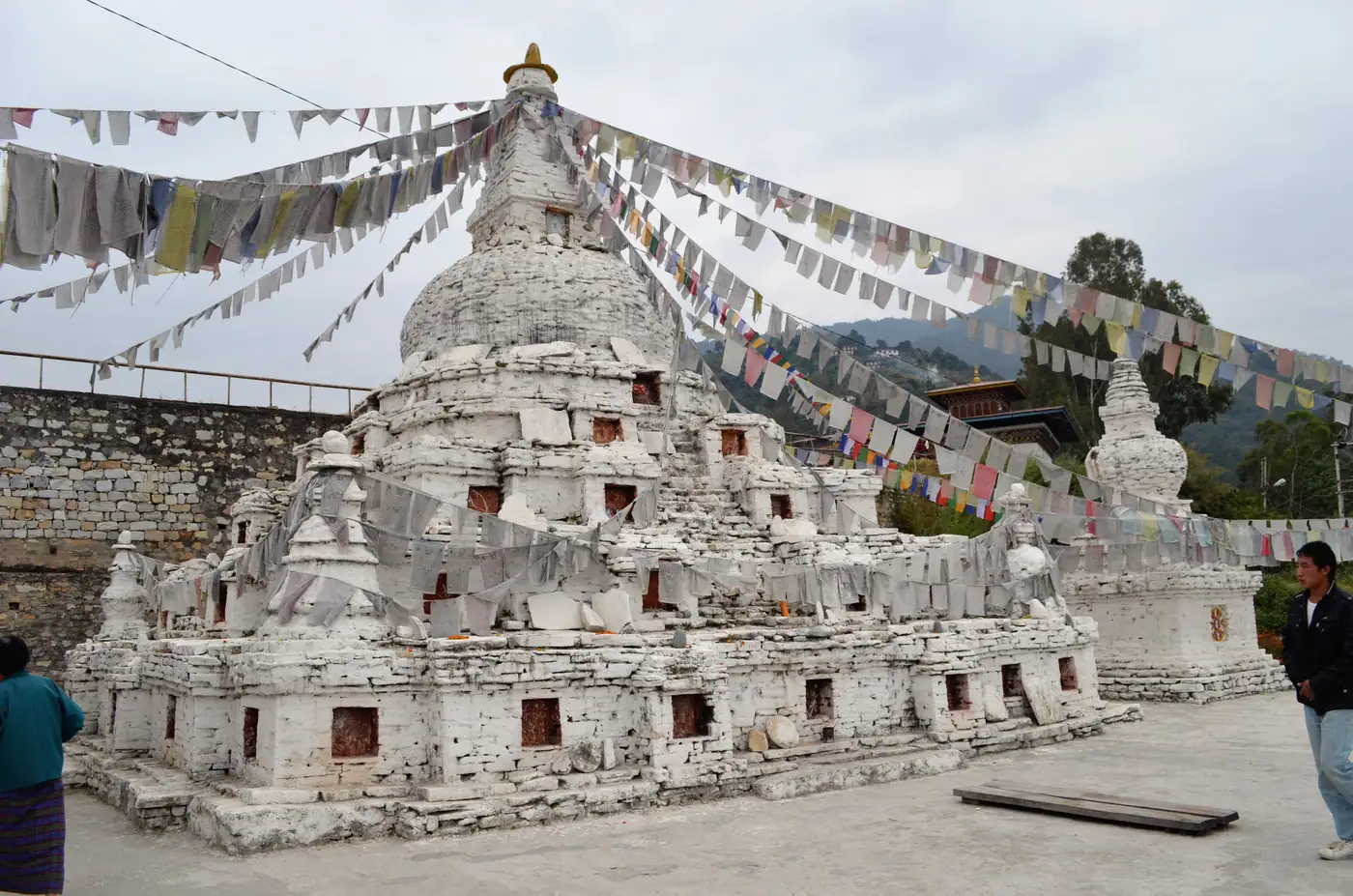
Paro Taktsang · 3,120 metres above the valley floor
Bhutan · Paro Valley
Tiger’s Nest and the Paro Valley
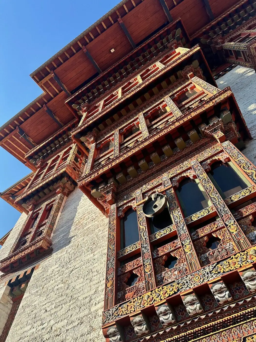
The Tiger’s Nest Monastery — Paro Taktsang — is plastered to a sheer cliff face at 3,120 metres at an angle that engineering cannot fully account for. Tradition says Guru Rinpoche landed here when he flew from Tibet on the back of a tigress. Whether you find this easy to believe depends on whether you need places to make rational sense.
The hike takes two to three hours through pine forest and prayer flags. Halfway up, a teahouse sits on a ridge above the valley floor where you can stop with a butter tea and look across to the monastery, still above you, suspended between rock and sky. Inside, the courtyards smell of pine resin and butter lamps. The walls are painted floor to ceiling — all watching.
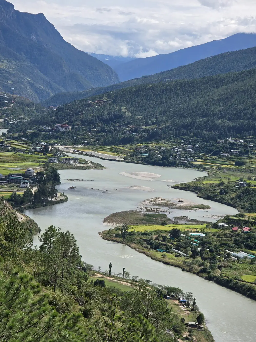
Paro Valley itself is wide by Bhutanese standards, braided with rivers and lined with apple orchards. There are no traffic lights in Bhutan. The town is a single street of whitewashed buildings with painted wooden facades and upturned eaves that curve at the corners the way old stories do.
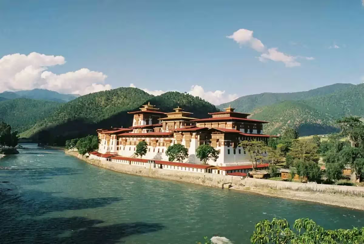
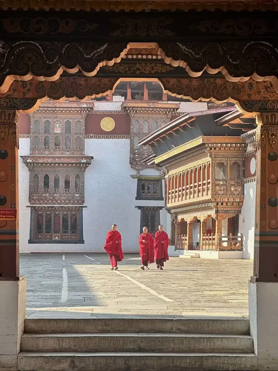
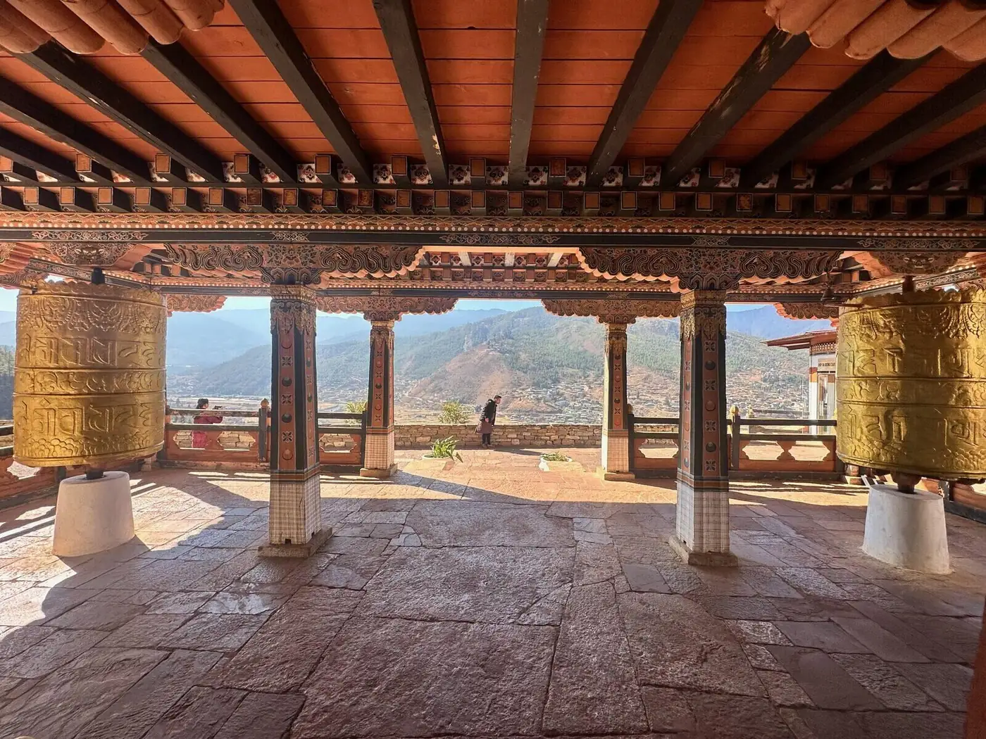
Punakha Dzong · confluence of the Mo Chhu and Pho Chhu
Bhutan · Punakha Valley
Punakha Dzong and the Valley of Two Rivers
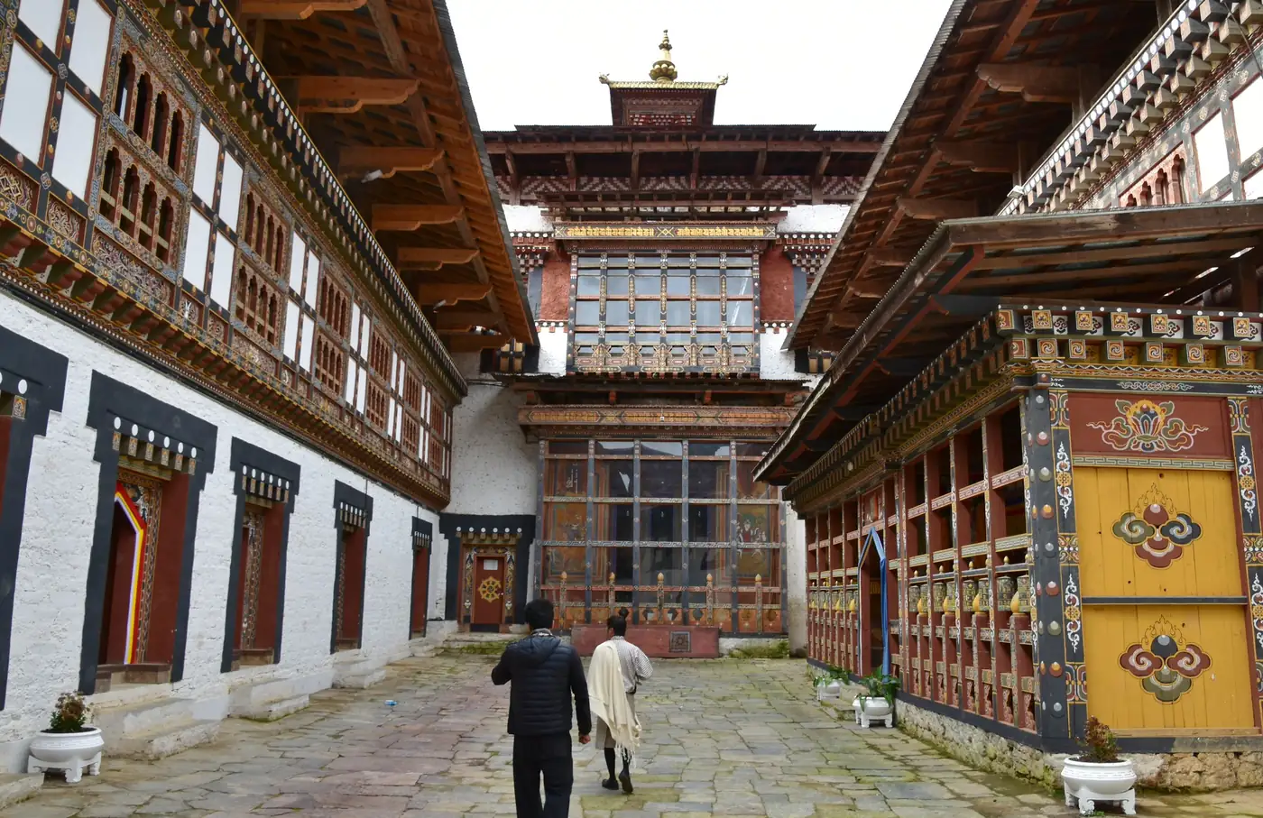
The Mo Chhu and the Pho Chhu — the mother river and the father river — meet at the base of the Punakha Valley, and at their confluence stands the Punakha Dzong: a fortress monastery built in 1637, five storeys of whitewashed stone and gilded towers rising from the riverbank as though the valley arranged itself around it.
In spring, jacaranda trees bloom purple along the approach bridge. In winter, the valley fogs overnight and burns off slowly in the morning, and the dzong emerges from the mist white and enormous, its spires catching the sun before anything else does. There are more beautiful buildings in the world. You will struggle to name one.
The road from Paro crosses the Dochu La pass at 3,116 metres, where 108 memorial chortens stand in a row and Himalayan peaks appear through the clouds like something being revealed slowly, on purpose. Leave time on the pass. The view does not rush.
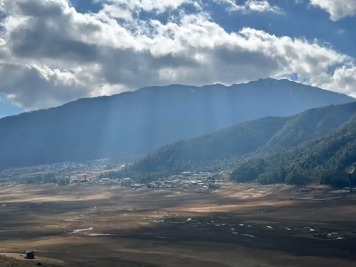
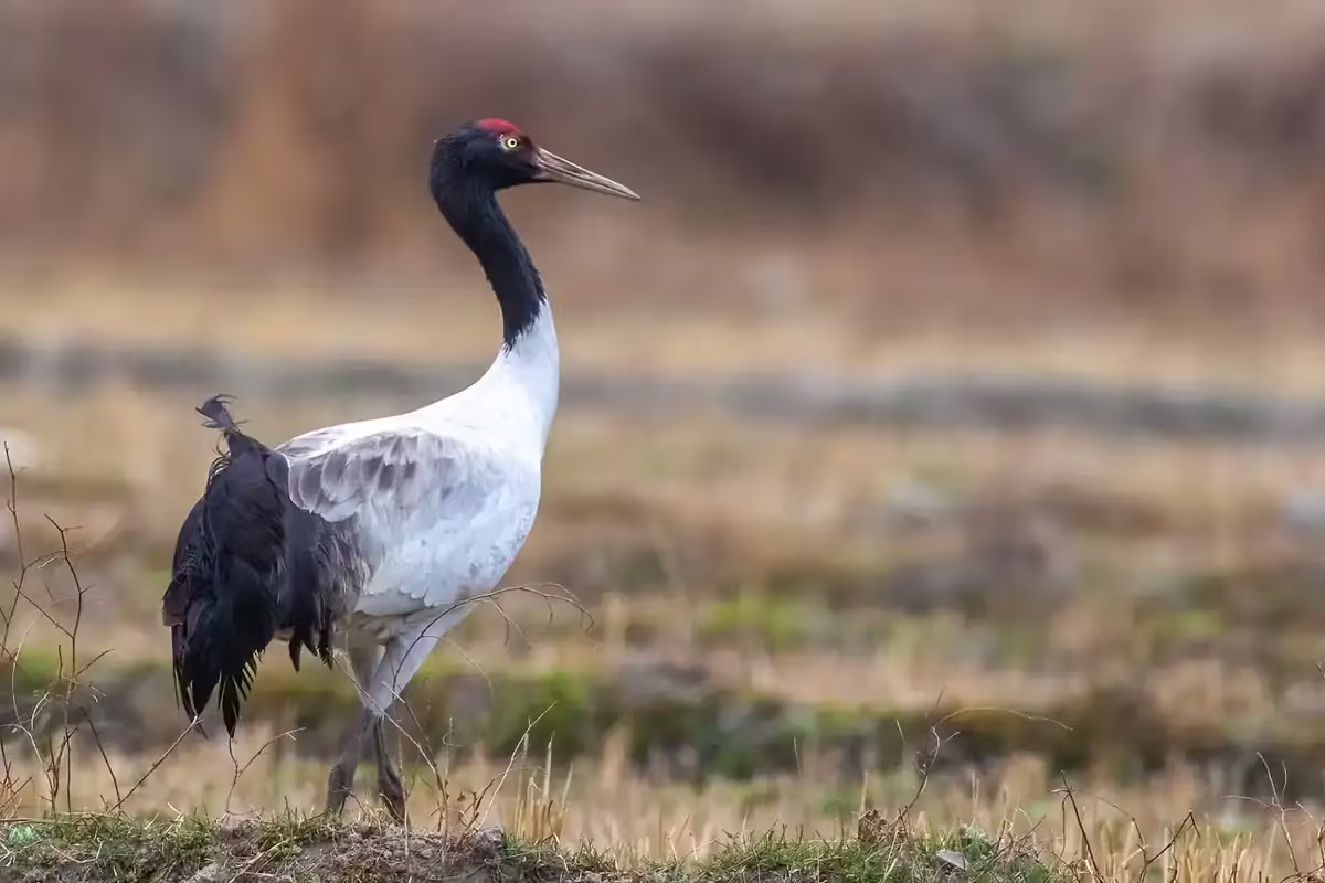
Gangtey · Phobjikha Valley at 2,900 metres
Bhutan · Gangtey & Phobjikha Valley
Gangtey and the Black-Necked Cranes
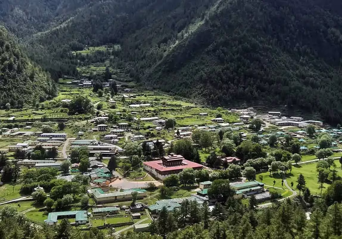
The Phobjikha Valley sits at 2,900 metres in the shadow of the Black Mountains, and every October it receives one of the most particular migrations in the world: the black-necked cranes arrive from Tibet to winter here, thousands of them, circling Gangtey Monastery on their descent as though the dzong is a waypoint they have memorised across centuries.
The valley is glacially formed, wide and treeless and utterly unlike the forested ridgelines everywhere else in Bhutan. In the early morning, with frost on the marsh grass and the cranes calling across the bowl of the valley, it is one of the stranger and more complete landscapes you will encounter anywhere — a place that does not require you to do anything but stand in it and pay attention.
Gangtey Monastery itself was founded in the seventeenth century. Local families have served as caretakers for generations. The community around it is intact, the cranes return because it is safe to return, and the geometry of the valley has not changed since the first Buddhist monks looked down into it from the surrounding hills.
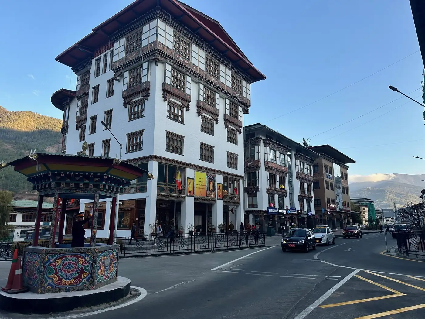
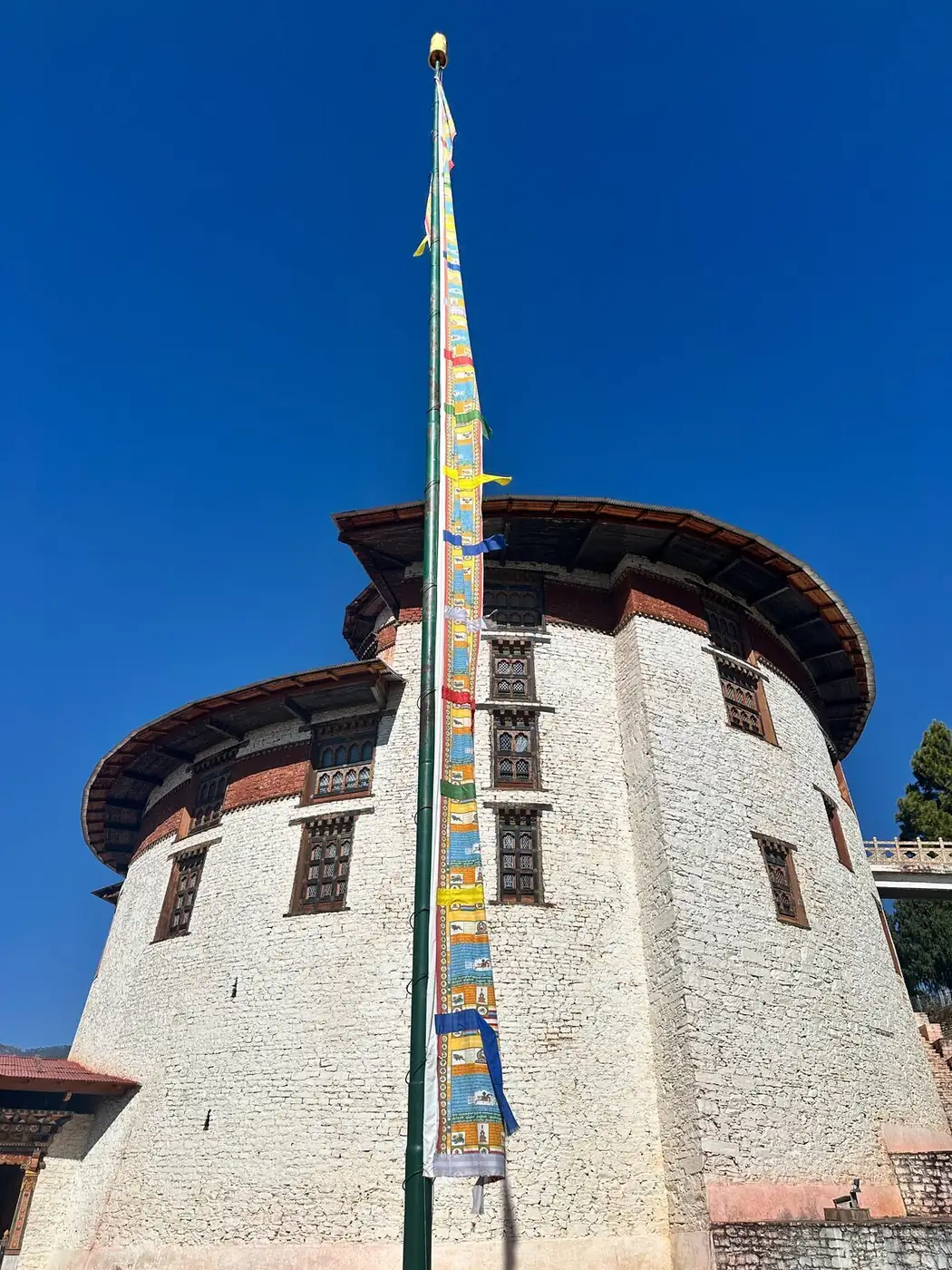
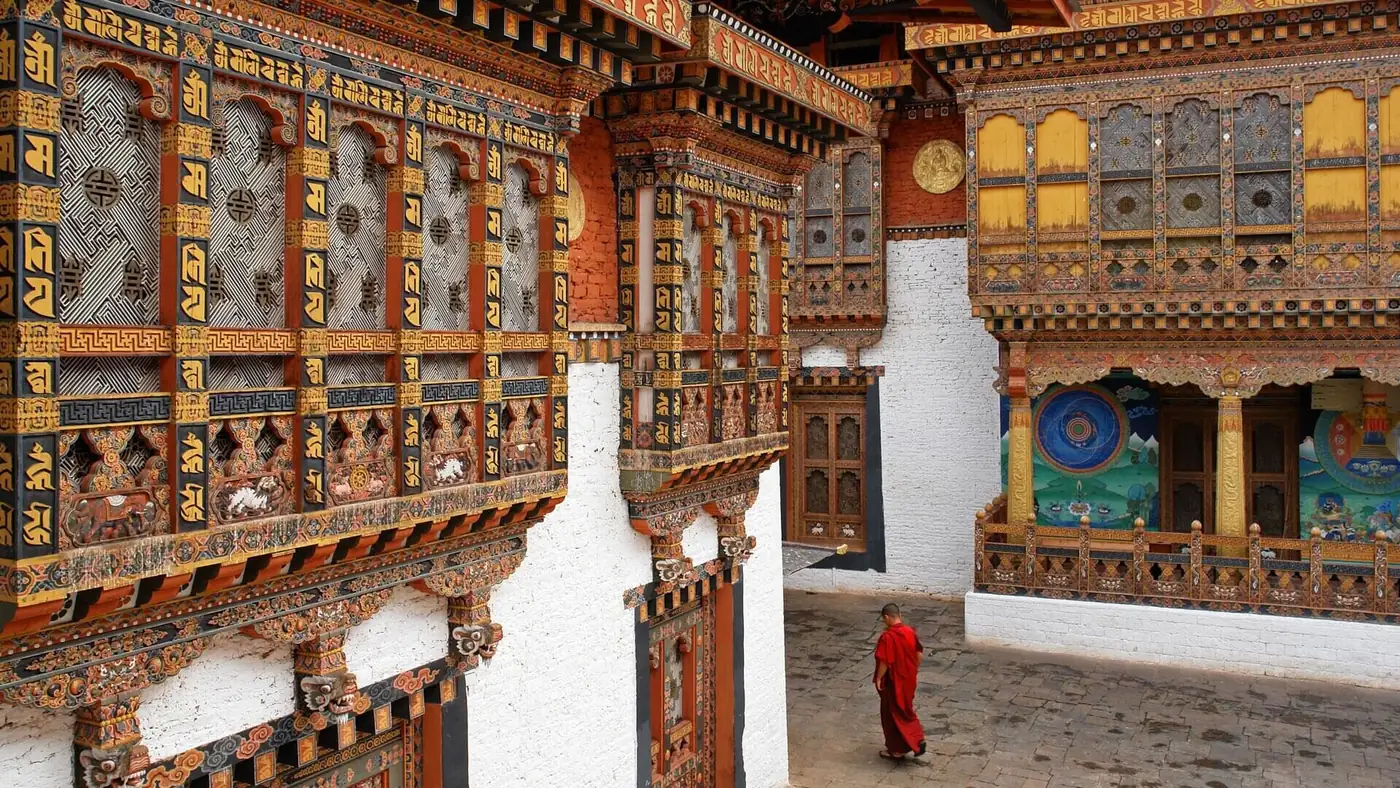
Thimphu · the capital with no traffic lights
Bhutan · Thimphu
Thimphu — The Capital With No Traffic Lights
Thimphu is the only capital in the world without a traffic light. They tried installing one. The complaints were loud enough that it came down. At the main intersection now stands a wooden kiosk where a policeman in a white peaked cap directs traffic with gloves and a choreography that looks, depending on the hour, like ballet or like a man trying to land a small plane.
Tashichho Dzong, in the middle of the city, houses both the government and the head of the monastic order — the running of the country and the saving of its souls under the same roof. An arrangement Westminster has not yet considered. Above the valley, on a forested hilltop, sits the Buddha Dordenma: 51 metres of bronze and gold, watching over Thimphu like a parent who has not stopped waiting up for you.
The weekend farmers’ market along the Wang Chhu: yak cheese in fist-sized rounds, dried chillies in volumes that suggest something between a pantry and a quiet threat. No chain stores. You can stand in the middle of the main street and hear prayer flags.
Bumthang · the spiritual heartland
Bhutan · Bumthang
The Spiritual Heartland
Bumthang is four valleys — Chokhor, Chumey, Tang, and Ura — in central Bhutan, considered the spiritual heart of the country. This is where Guru Rinpoche (Padmasambhava) is said to have meditated in the 8th century, and the temples and monasteries scattered through the valleys are some of the oldest in the country. Jambay Lhakhang, in Chokhor, dates to 659 CE: older than the country itself.
The drive from Punakha to Bumthang takes a full day, crossing two passes above 3,000 metres. The valleys are wider here, slower, agricultural. Buckwheat pancakes for breakfast. Honey from local apiaries. A direct flight from Paro (45 minutes) cuts the road time considerably and is worth it. The region is closed for several festivals each year — the Jambay Lhakhang Drup, in October, includes a fire dance and a naked masked-dance ritual that goes back centuries.
Haa Valley · the border with Tibet
Bhutan · Haa Valley
The Border with Tibet
Haa Valley is in the far west of Bhutan, sharing a high pass with the Chumbi Valley in Tibet. It opened to foreign visitors only in 2002 — Bhutan’s most recently accessible region. The valley is small, narrow, and quiet: a single river, a handful of villages, and the Chele La pass at 3,988 metres connecting it to Paro. On clear days from the pass, you see Jomolhari (7,326m) and the Tibetan border peaks.
The Haaps — people of the Haa Valley — are a distinct cultural group with their own dialect and farming traditions. The valley produces some of the best buckwheat in Bhutan, and the small Haa Summer Festival in July is one of the few events in the country where you can sit with locals over chhang and butter tea without it feeling staged.
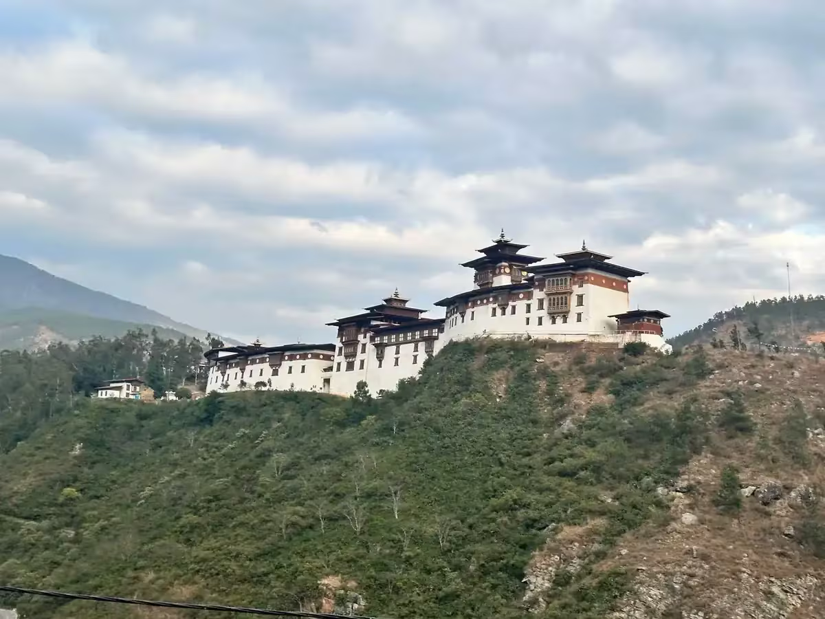
Trongsa · the largest dzong in Bhutan
Bhutan · Trongsa
The Ancestral Seat of the Monarchy
Trongsa Dzong, on a ridge above the Mangde Chhu river, is the largest and most strategically positioned dzong in Bhutan. Every Bhutanese king has served as the Penlop (Governor) of Trongsa before ascending the throne. The fortress is enormous — 25 lhakhangs and a sequence of courtyards that drop down the ridgeline — and it controls the historic east-west road through the country. From the watchtower, you can see for forty kilometres.
The town itself is small. The dzong, the National Museum housed in the watchtower, and the road-stop hotels are most of what’s there. But the drive in — through the Black Mountains, past the Yotong La pass at 3,425 metres — is the experience. Trongsa is roughly the geographic centre of Bhutan, and you cannot drive across the country without passing through it.
Mongar · the gateway east
Bhutan · Mongar & Eastern Bhutan
The East
Mongar is the gateway to eastern Bhutan, a region most travellers never reach. The drive from Bumthang takes you over Thrumshing La (3,750m), the highest road pass in the country, and the landscape changes: forests of rhododendron and oak, deeper valleys, smaller villages, almost no other foreign visitors. The east is poorer than the west, and slower, and it produces some of the country’s finest weavers.
Mongar Dzong is unusual: it was built in 1953, making it one of Bhutan’s youngest fortresses, and it sits on a ridge rather than at a river confluence. The Sherubtse College in Kanglung, an hour east, was Bhutan’s first university and still has the feel of an experiment in education on the side of a mountain. Eastern Bhutan rewards travellers who are willing to drive a long way to see things that almost nobody else has seen.
Bumdeling · where the cranes winter
Bhutan · Bumdeling Wildlife Sanctuary
Where the Black-Necked Cranes Winter
Bumdeling Wildlife Sanctuary is in far northeastern Bhutan, a 1,520 square kilometre protected area that runs from subtropical valleys to alpine peaks above 6,000 metres. The sanctuary is home to red pandas, snow leopards, and the largest wintering population of black-necked cranes in Bhutan — about 100 birds arrive each year from the Tibetan plateau in late October and stay until early March.
Access is real work: the road to Bumdeling crosses Thrumshing La and continues east through Mongar and Trashiyangtse. Most years, fewer than 50 foreign visitors make it to the sanctuary at all. The cranes are the draw, but the broader landscape — high alpine pasture, untouched temperate forest, traditional villages still working the same yak-grazing patterns as centuries ago — is the longer reward.